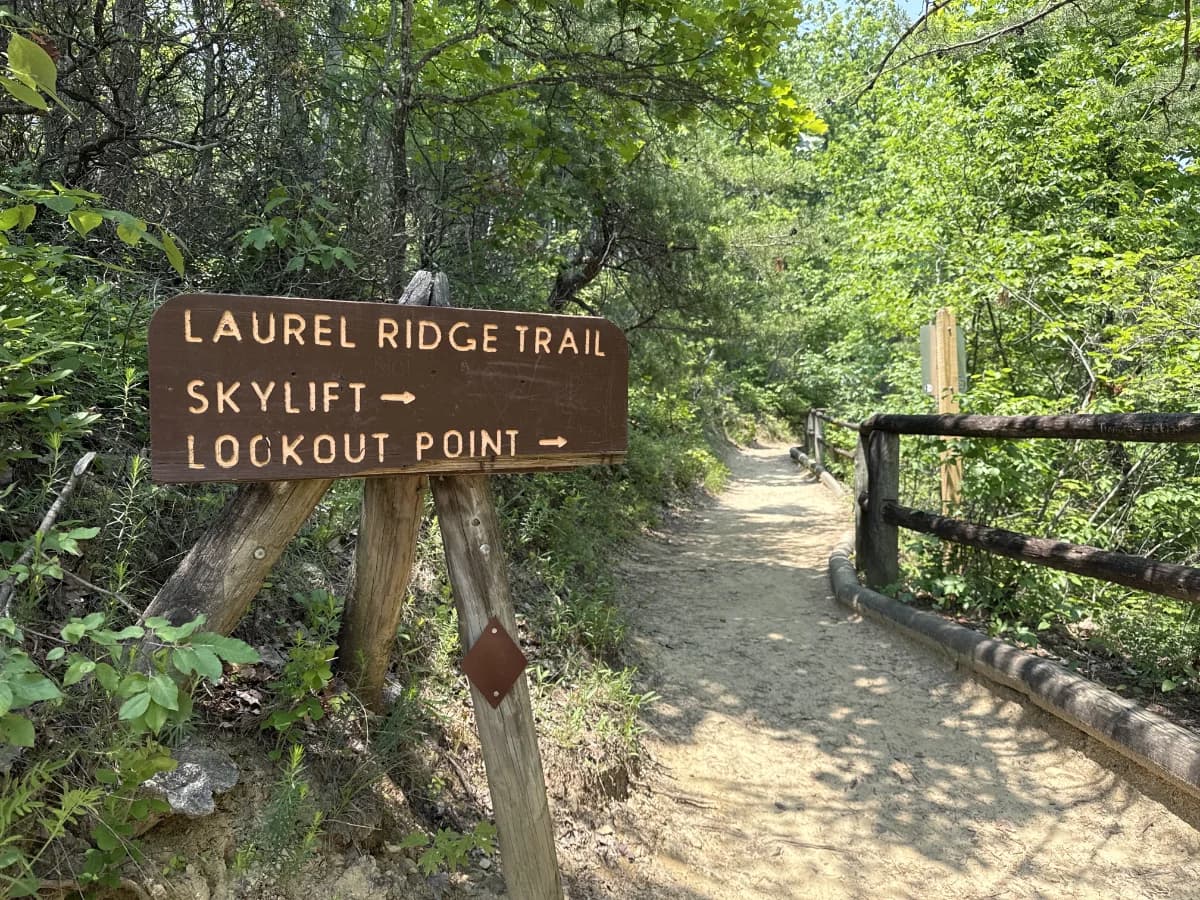
Laurel Ridge Trail
Trail Overview
Located at the top of Natural Bridge State Resort Park in Powell County, Laurel Ridge Trail is a linear trail with a difficulty rating of Easy. This trail boasts some of the best views that you'll find in the entire park.
Trail Access
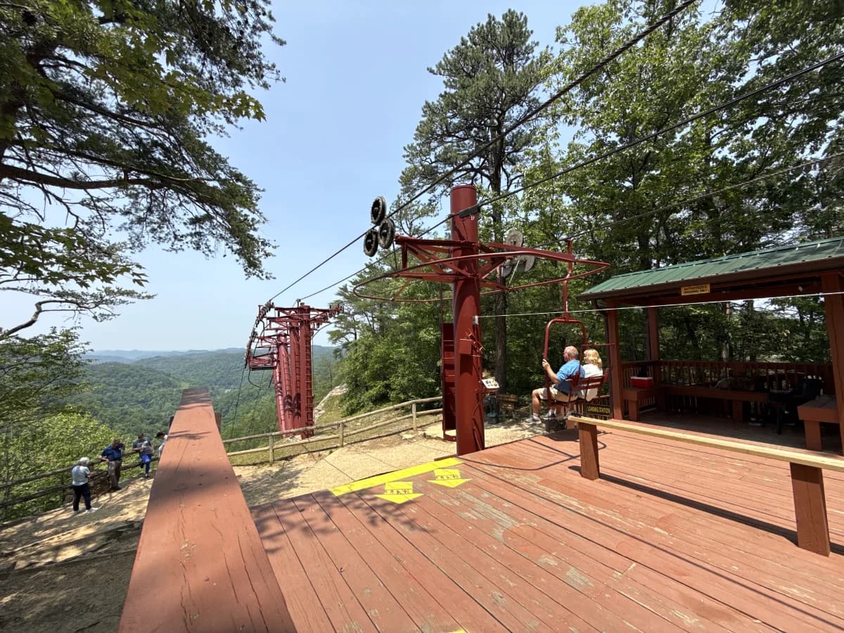
Hikers can park at the skylift parking lot or near the gift shop depending on which way you want to get to the trail. The skylift brings hikers directly to Laurel Ridge Trail on the side closest to the Natural Bridge for easy entry to both. The trail can also be accessed after crossing the Natural Bridge or via Devils Gulch and Needles Eye stairways.
Waypoints
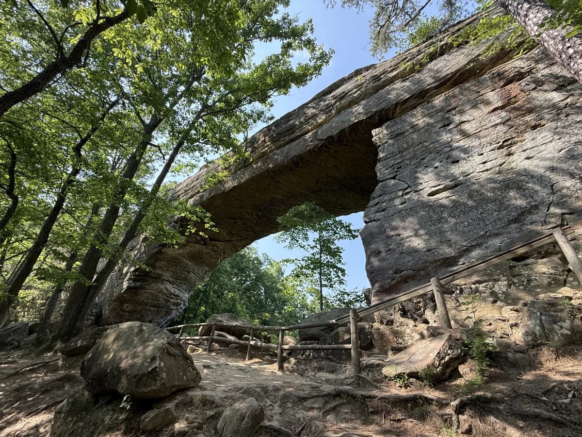
Natural Bridge
The main attraction at Natural Bridge State Resort Park, this sandstone arch spans 78 feet and is 65 feet high. Many of the trails at this park lead up to the base of the natural bridge. Any hikers who are unable to make the trek up to the arch can ride up via the skylift which will let you out onto Laurel Ridge Trail in which you’ll follow to the top of the arch
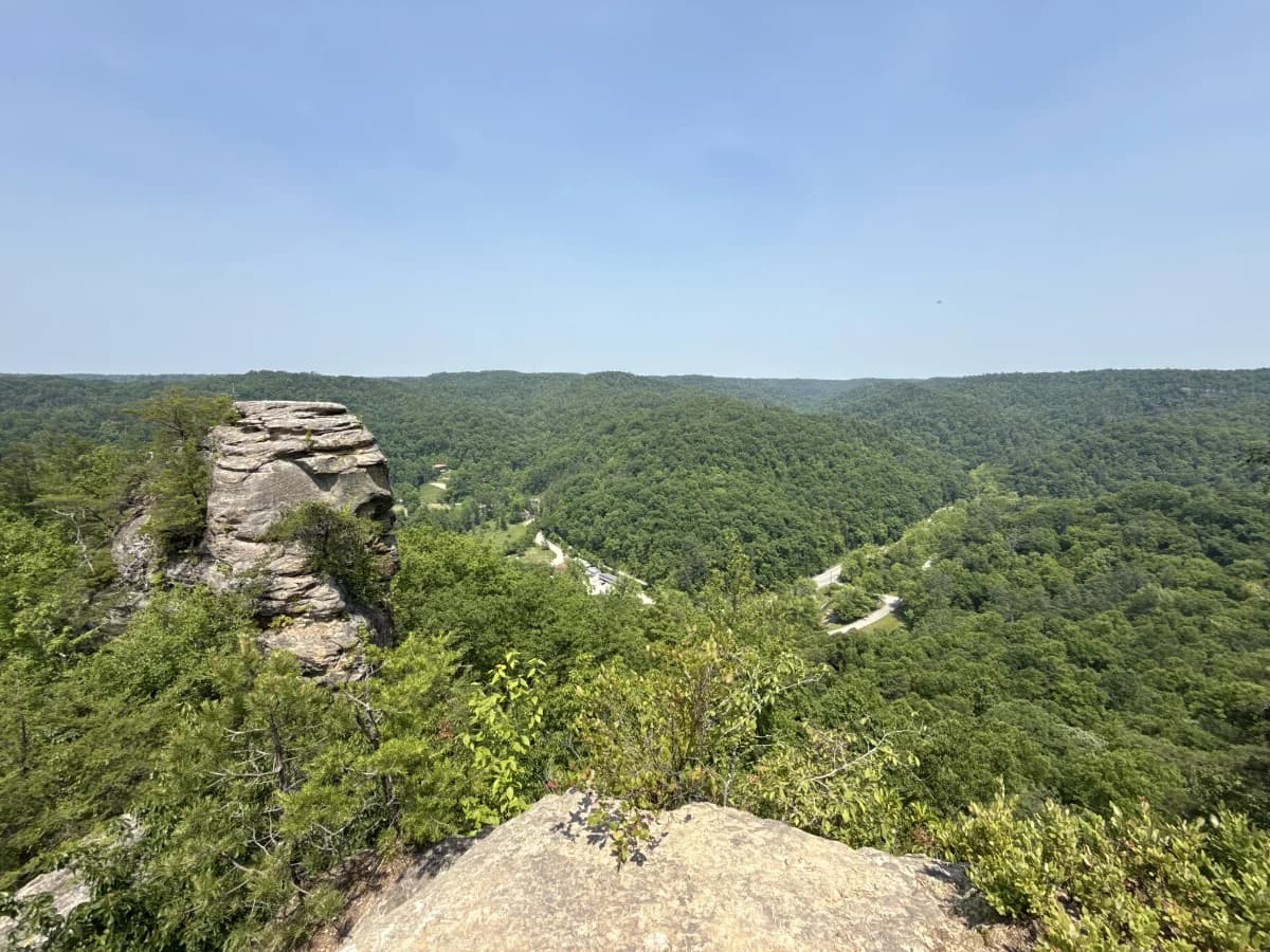
Lovers Leap
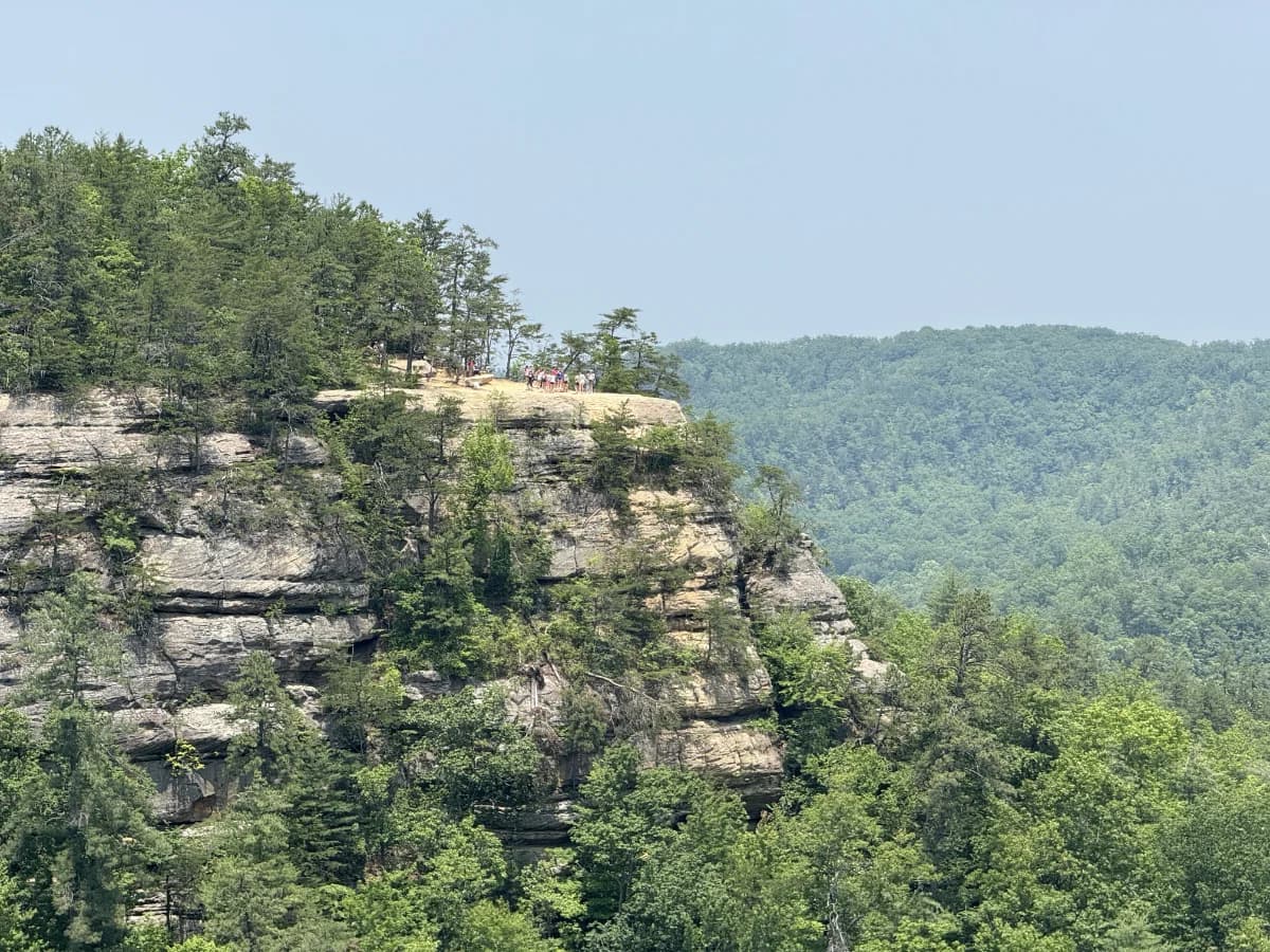
Located at the far end of Laurel Ridge Trail opposite of the Natural Bridge, you will find Lovers Leap. This overlook provides a beautiful view of the gorge and is home to an interesting rock formation that looks like a face if you view it from a certain angle.
Lookout Point
Lookout Point is an ideal place to view both the Natural Bridge and Battleship Rock from a different vantage point when traveling along Laurel Ridge Trail.